
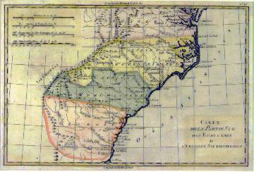
751 "Carte de la Partie Sud des Etats Unis de L'Amérique Septentrionale", c.1650. This hand-painted map of the southern United States features Virginia in light purple, North Carolina in yellow, South Carolina in green, and Georgia in coral. The Appalachian Mountains separate the colonies from the unchartered territory occupied by "les Cherokees". Museum matted and framed to an overall size of 19 x 14.75". Fine.
Estimated Value $750-1,000.